File:Sharif edrisi.jpg
Jump to navigation
Jump to search
Size of this preview: 800 × 585 pixels. Other resolution: 1,478 × 1,080 pixels.
Original file (1,478 × 1,080 pixels, file size: 330 KB, MIME type: image/jpeg)
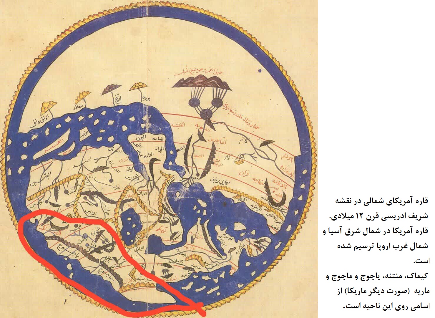
قاره آمریکای شمالی در نقشه شریف ادریسی قرن 12 میلادی. قاره آمریکا در شمال شرق آسیا و شمال غرب اروپا ترسیم شده است. منتنه، یاجوج و ماجوج و ماریه (صورت دیگر ماریکا) از اسامی روی این ناحیه است.
File history
Click on a date/time to view the file as it appeared at that time.
| Date/Time | Thumbnail | Dimensions | User | Comment | |
|---|---|---|---|---|---|
| current | 11:49, 19 October 2021 | | 1,478 × 1,080 (330 KB) | Bashir (talk | contribs) |
You cannot overwrite this file.
File usage
There are no pages that use this file.